First CDS dSalon of the semester
Henricus Martellus’s World Map at Yale (c. 1491): Multispectral
Imaging, Sources, Influencet
Chet Van Duzer (David Rumsey Map Center-John Carter Brown Library Fellow)
Tuesday 10/09 at 2:00pm
Digital Studio, Rockefeller Library
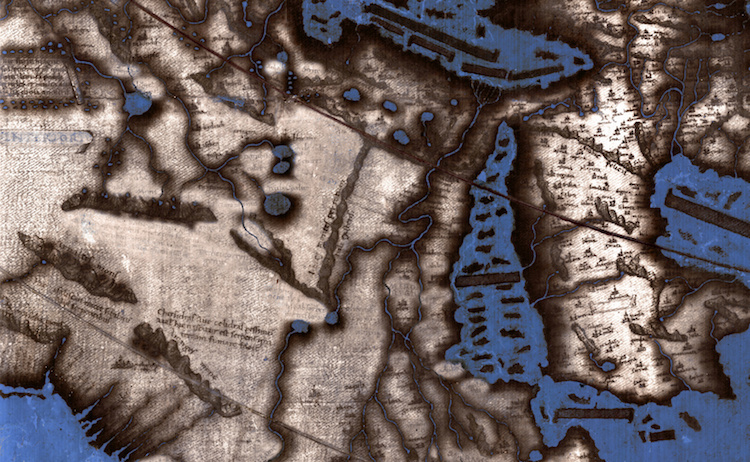
This talk gives an account of a new book about a project funded by the
National Endowment for the Humanities to make multispectral images of
a world map made by Henricus Martellus in about 1491, which is held by
the Beinecke Library at Yale. This large map had long been thought to
be one of the most important of the fifteenth century, and was thought
to have influenced Martin Waldseemüller’s world map of 1507, one of
the treasures of the Library of Congress, but the many texts on the
map were illegible due to fading and damage, and thus its exact place
in Renaissance cartography was impossible to determine. The new
multispectral images have rendered most of the previously illegible
texts on the map legible. I will explain why the Martellus map was an
excellent candidate for multispectral imaging, describe the process of
making the images, show the results, and situate the Martellus map in
late fifteenth- and early sixteenth-century cartography.
Chet Van Duser is an Independent scholar who is the David Rumsey Map
Center-John Carter Brown Library Fellow
########################################################################
To unsubscribe from the BOSTONDH list, click the following link:
https://listserv.neu.edu/cgi-bin/wa?SUBED1=BOSTONDH
|


